
FIELD SURVEY JOURNEY ALONG THE COAST OF THE MEKONG DELTA
October 13, 2026
Eastern Coast of the Mekong Delta
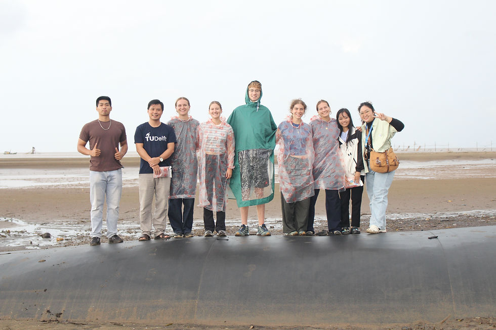
Researchers from the Institute of Coastal and Offshore Engineering (ICOE) and five master's students from Delft University of Technology (TU Delft).
The field survey was conducted from 8 to 12 October 2026 to investigate the current conditions of coastal protection structures, survey mangrove forests, and assess the relationships between dikes, revetments, shoreline changes, and coastal ecosystems. In addition to field surveys, the team installed wave and current measurement equipment and tested hydrometeorological and oceanographic monitoring instruments to support data collection in the study area.
8 October 2026 – Survey of Coastal Protection Structures at Tan Dien and Con Lon
Morning – Tan Dien Beach, Dong Thap Province
The team traveled from Ho Chi Minh City to Tan Dien Beach to survey the existing coastline, mangrove forests, and coastal protection structures. The survey focused on nearshore revetments and nearshore low-crested or submerged breakwaters to investigate their roles in reducing wave impacts and protecting coastal areas.
Afternoon – Con Lon Beach, Vinh Long Province
The team continued to Con Lon Beach to examine geotextile tube dikes and survey the existing coastline and coastal vegetation. The activities aimed to document the characteristics of the structures and the natural conditions of the study area.
9 October 2026 – Survey of Coastal Protection Structures and Hydrological Monitoring Systems
Morning – Rock Groynes at Con Cu Hamlet, Duyen Hai, Vinh Long Province
The team surveyed rock groynes combined with concrete piles. The activities focused on understanding the structural design, the arrangement of coastal protection components, and the existing conditions of the surrounding coastal area.
Early Afternoon – Dai Ngai Hydrological Station, Can Tho City
The team visited a self-recording water-level monitoring installation belonging to the national hydrological monitoring network to learn about its operating principles and data collection procedures. The team also tested several measuring instruments to assess their operational performance and suitability for field measurements.
Following Activity – Vinh Hai Beach, Can Tho City
The team proceeded to Vinh Hai Beach to further investigate the natural conditions and current state of the coastal area. Detailed survey findings will be updated based on the actual activities conducted in the field.
10 October 2026 – Mangrove Survey and Installation of Measurement Equipment
Morning – Coastal Area of Lai Hoa Commune
The team surveyed the condition of mangrove forests and coastal erosion in Lai Hoa Commune. Activities focused on documenting vegetation distribution, shoreline conditions, and changes within the survey area. The collected information provides a basis for investigating the relationships between mangroves, shoreline dynamics, and coastal protection structures.
Afternoon – Soc Trang 1 Wind Farm Area
The team installed several hydrodynamic and oceanographic measuring instruments, focusing on wave and current parameters. The installation was intended to support field data collection and research into coastal hydrodynamic conditions.
11 October 2026 – Continued Field Surveys and Completion of Measurement Activities
Morning – Coastal Area of Lai Hoa Commune
The team continued surveying mangrove forests and coastal erosion in Lai Hoa Commune. The activities aimed to supplement field observations, document notable characteristics of the study area, and support comparisons with data collected throughout the research process.
Afternoon – Soc Trang 1 Wind Farm Area
The team continued installing, inspecting, and testing the wave and current measurement equipment. The activities focused on ensuring that the instruments operated reliably and were ready for hydrodynamic and oceanographic data collection.
12 October 2026 – Data Processing and Conclusion of the Field Survey
In the morning, the team processed, compiled, and conducted preliminary quality checks on the data collected during the field survey at the hotel. At 14:00, the team began dismantling the measurement equipment, completed the fieldwork, and departed for Ho Chi Minh City.
Significance of the Field Survey
The field survey provided an opportunity to collect practical information on coastal protection structures, mangrove conditions, and shoreline erosion at several locations along the Mekong Delta coast. Combined with wave and current measurements and water-level monitoring, the field observations contribute to the development of a supporting dataset for investigating the relationships among coastal protection structures, hydrodynamic conditions, and mangrove ecosystems.