

DAI NGAI HYDROLOGICAL STATION
Location Overview
Dai Ngai Hydrological Station is situated on the main branch of the Hau River within Soc Trang Province. Within the research network of the Mekong Delta Living Lab project, Dai Ngai is not a direct coastal site affected by sea waves; however, it holds a strategic and decisive position. It serves as a vital input boundary station, monitoring and controlling the supply of water and sediment before they are distributed along the coastal strip spanning from Tra Vinh, Soc Trang, and Bac Lieu to Ca Mau.


Importance to the Coastal Areas
The decline in silt and changes in flow regimes represent the greatest challenges to the survival of mangrove forests and coastal morphology in the Mekong Delta. The Dai Ngai station provides critical quantitative data on sediment flux from the upstream Hau River to key downstream research sites such as Vinh Chau and Nha Mat. Data collected here allows experts to accurately assess how sediment supply impacts the potential for accretion or the risk of erosion across the entire coastal study area.
Sediment Dynamics and Challenges
Studies indicate that sediment dynamics in the region are being heavily altered by anthropogenic drivers, such as hydropower dam construction and sand mining activities. These activities significantly reduce the system's capacity for sediment export, turning some river branches (such as the Dinh An branch) into sediment "sinks." This increases imbalance and accelerates coastal erosion. Maintaining monitoring at Dai Ngai helps directly track these upstream fluctuations.
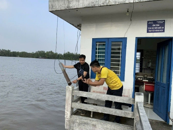
Fieldwork and Monitoring Activities
To collect continuous and high-precision data, in early October 2025, a team of experts from the Institute of Coastal and Offshore Engineering (ICOE) in collaboration with students from the MDP program (TU Delft University) deployed suspended sediment monitoring equipment at the Dai Ngai station.
-
Equipment used: The station is equipped with a Riverkin sedimentation sensor.
-
Measured parameters: The sensor continuously records key parameters including Turbidity (NTU), Temperature, and Pressure.
-
Data management: All collected data is transmitted and updated continuously to the Database System for Mekong Living Lab, allowing users to retrieve, filter data in real-time, and visualize it through charts.


Ongoing and Future Works
Hydrological and sediment monitoring data at Dai Ngai will continue to serve as essential input parameters for establishing and calibrating the project’s hydrodynamic models (utilizing the FlowFM flexible mesh of the Delft3D modeling system). The combination of field-measured data at the Dai Ngai boundary and numerical simulations of waves and currents will provide a comprehensive and accurate picture of sediment transport from the river to the sea. This provides a solid scientific basis for assessing the survival capacity of mangroves under hydrodynamic impacts, thereby supporting the proposal of effective Nature-based Solutions for erosion control in the Mekong Delta.