
VINH CHAU – SOC TRANG
INTRODUCTION
Vinh Chau, a coastal area in Soc Trang Province, plays an important role in the local coastal protection system and coastal livelihoods. The area is characterized by a combination of sea dikes, aquaculture zones, and mangrove belts that are undergoing restoration, contributing to the protection of agricultural land and the reduction of wave and wind impacts.

Figure 1. Vinh Chau (Soc Trang)
However, similar to many coastal areas in the Mekong Delta, Vinh Chau faces challenges such as localized erosion, shoreline changes, and pressure to maintain and restore mangrove coverage amid land-use conversion and aquaculture expansion. In addition, dike systems and human activities influence hydrodynamic exchanges and sediment transport processes, thereby affecting the long-term coastal protection function of the mangrove ecosystem.
The Vinh Chau – Soc Trang fieldwork was conducted at a time when the research team identified several noteworthy coastal phenomena along the Vinh Chau shoreline. There was also a clear need to initiate activities in areas where mangroves remain healthy and are less affected by human intervention. More importantly, the mangrove coast of Vinh Chau can be considered Living Lab, where fixed boundaries can be established to support long-term monitoring and measurements.
Building on this rationale, a series of field surveys were conducted at the beginning of 2025 across Soc Trang and Bac Lieu provinces. These surveys aimed to update and consolidate information on the current status of mangrove ecosystems in the region, while also identifying representative sites for detailed investigation.
Following the preliminary surveys, an intensive measurement campaign was carried out from 10 to 21 June. This campaign included a comprehensive set of field activities, such as the measurement of offshore and nearshore wave conditions, acquisition of offshore current data, and collection of suspended sediment concentration (SSC) and bed sediment samples. In parallel, bathymetric surveys and mangrove structural assessments were conducted to provide an integrated understanding of the coastal system. Overall, the measurements focused on key physical and ecological parameters, including water levels, wave dynamics, sediment characteristics, and mangrove biomass.


Figure 2. Locations of stations. The left figure includes the nearshore and offshore wave-flow stations (WB and Flow). The right figure consists of a nearshore wave station (WG01), Suspended Sediment Concentration (SSC01 and SSC02), Bed Sedimentation (BSd-011 to BSd-033), Standard Mangrove Measured Size (OTC-01 to OTC03) and Cross-shore profiles (yellow lines). Vinh Chau Fishery Port is located in the north, where the team works with partners.
ACTIVITIES AND RESULTS
The field activities included a series of surveys conducted in Sóc Trăng and Bạc Liêu provinces to obtain updated information on the current status of mangrove forests in the study areas. In parallel, wave buoys were deployed and transported to monitor nearshore wave conditions, while wave-measuring instruments were installed to continuously record wave dynamics and water levels within mangrove ecosystems. In addition, suspended sediment samples were collected at river mouths and canal outlets to support the analysis of sediment transport processes.
During the field campaign, the research team worked closely with local authorities and communities to better understand their perspectives and long-term vision for the proposed Living Lab. These discussions also helped identify potential locations for establishing monitoring infrastructure. Field observations and stakeholder consultations highlighted several key coastal conditions, including severely eroded areas such as Lai Hoa (Vinh Chau, Soc Trang), zones where breakwaters have been constructed and mangrove forests are showing signs of recovery such as Nha Mat (Bac Lieu), as well as newly protected areas with recent mangrove replanting and coastal defense structures.
Based on these conditions, a combination of nearshore and offshore monitoring equipment was deployed. Wave buoys (WB2006, Obscape) and Acoustic Doppler Current Profilers (Sentinel-V20, US) were installed at offshore locations to measure wave and current dynamics. Nearshore wave conditions and water levels were monitored using the TWR2050R-RBR logger and Diver (Van Essen) instruments. In addition, a radar water level system (PTM6003) was installed at the Hoa Binh Wind Farm site. Complementing the instrumental measurements, suspended sediment and bed sediment samples were also collected manually at selected locations to support laboratory analysis of sediment characteristics.
Here are photos from the fieldwork for device installation:
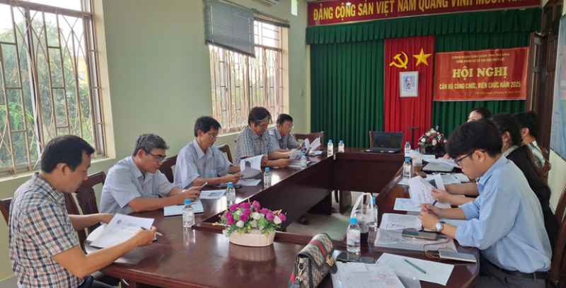
Figure 3. Meeting with the local authorities

Figure 4. Discussing mangrove forests with local people


Figure 5. Survey the recently reforested mangrove areas


Figure 6. Wave buoy (left) and Sentinel-V20-ADCP (right panel)

Figure 7. Wave data records from Sentivel-V20 at the offshore location, including water depth (bottom panel)


Figure 8. AEM213 installation

Figure 9. Flow velocity distribution at z = 0.85 m (close to sensor of Sentinel-V20)
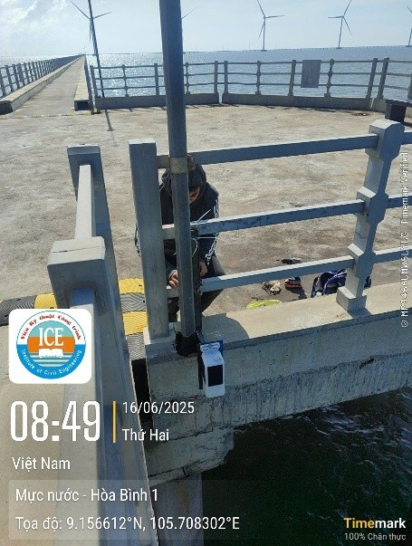


Figure 10. Radar water level PTM6003 (left), Logger RBR (middle) and Divers (right)

Figure 11. Water depth from Divers at nearshore location (See Table 3.1 and Figure 3.1)
Nevertheless, suspended and bed sediment samples are collected in a traditional way at chosen locations based on the actual situations. In Figure 3.5, suspended sediment samples are collected at two locations, near the shore and offshore. Samples are kept in a plastic bottle (01 Litre) and filtered with special papers, date and time are carefully recorded for later analyzing. Bed sediment samples are collected manually at chosen locations along the chosen cross-shore profile (Figure 3.1). The figures below present actual activities in the field.
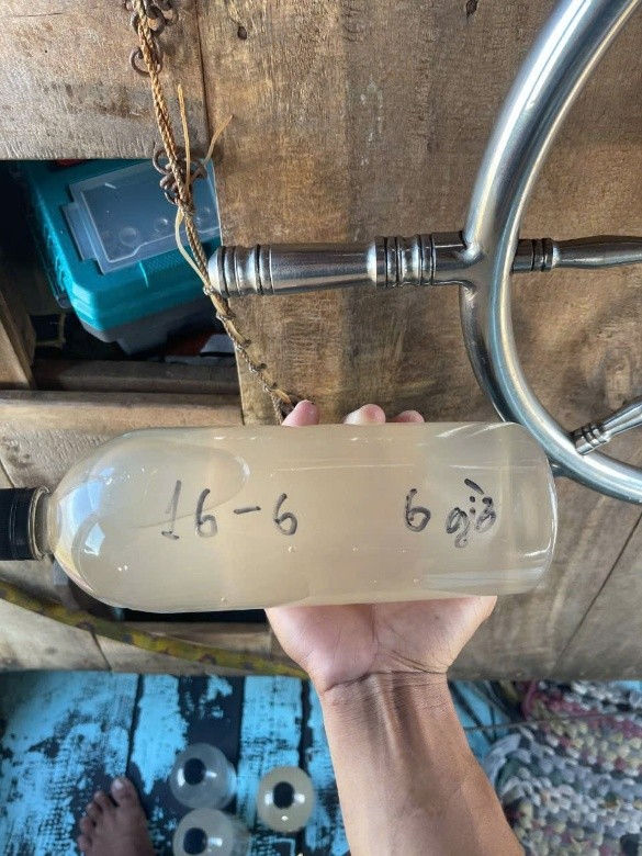
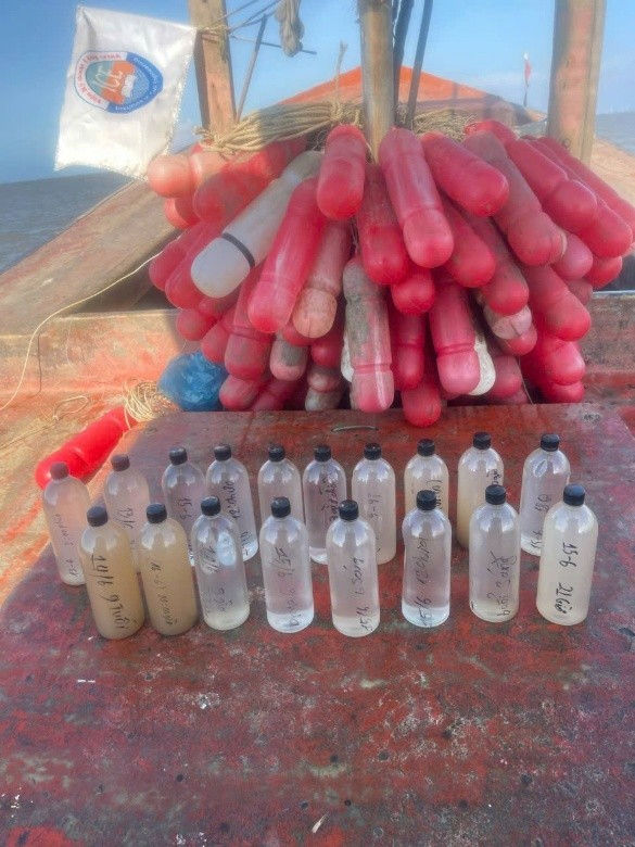
Figure 12. Suspended Sediment samples are collected and kept in a plastic bottle at the offshore station.
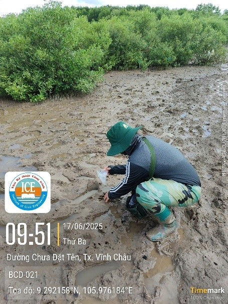


Figure 13. Collecting bed sediment samples